INTERPRETING WEATHER MAPS, TOOLS & CLOUDS |
6.E.2B.1 Analyze and interpret data from weather conditions (including wind speed and direction, air temperature, humidity, cloud types, and air pressure), weather maps, satellites, and radar to predict local weather patterns and conditions.
|
|
Essential Knowledge
Meteorologists can predict the weather by analyzing and interpreting data from observations and tools such as current weather conditions, weather maps, satellites, and radar images. • Changes in the following weather conditions can indicate a change in the pattern of weather. o Wind speed is measured using an anemometer and indicates a change in atmospheric flow patterns o Wind direction is measured using a wind vane (also known as a weather vane) and indicates the direction of advancing air masses. o Temperature is measured using a thermometer. Changes in the air masses result in changes in the temperature. o Humidity can be measured with sling psychrometers or hygrometers. Humidity is a measure of the percentage of water vapor in the air. Increased levels of humidity can be associated with a high probability of precipitation. o Air pressure is measured with a barometer. A rise in air pressure indicates fair weather while a fall in pressure indicates stormy weather conditions advancing. o Basic shapes of clouds are associated with weather patterns. Cirrus clouds are high and wispy and signal fair weather or an approaching warm front Cumulus clouds are puffy with flat bottoms and signal fair weather. However, when they are darker, they may signal rain or thunderstorms, as they develop into cumulonimbus clouds (thunderheads). Stratus clouds are spread over a large area and are layered. As these clouds thicken long periods of precipitation can occur over the area where the clouds are located. • Weather maps o Weather maps can help predict weather patterns by indicating high or low pressure systems (isobars), movement of air masses and fronts, or temperature ranges (isotherms). • Satellites o Satellite images are used for seeing cloud patterns and movements. o For example, hurricane clouds and movement can be observed using satellite images. • Radar o Radar images can be used to detect cloud cover, rainfall, storm location or intensity, and cloud movement, as well as the potential for severe weather (for example, hurricanes or tornadoes). Extended Knowledge Station models from specific locations provide information that can also be used to predict weather patterns. Information found on a station model can include cloud cover, temperature (85°F), wind direction and speed, precipitation (* - snow, ● – rain), or barometric pressure (1002 mb). Meteorology is based on probability. Therefore, predictions are not always accurate. The basic shape name of a cloud can be combined with the appropriate prefix or suffix listed below as clues to the weather conditions that may result. • Combinations of those shapes can be used with nimbus, which means “rain”, for example, cumulonimbus or nimbostratus. • A cumulonimbus cloud, also called a thunderhead, is often part of thunderstorm conditions that may accompany a cold front. • The prefix alto- may also be used to indicate medium-level clouds formed at about 2-6 kilometers up into the atmosphere, for example, altocumulus or altostratus. |
CLASSROOM RESOURCESWeather Tools & InstrumentsWeather Tools Book PagesQuiz-Quiz-Trade Flashcards
Student Packet: Weather Instruments to use with Kagan Numbered Heads Strategy from Marge LaPorte at Loris Middle School. :)
Student Packet: Weather Instruments & Data-Warm Ups, Vocabulary, Information & WorksheetsWeather Instruments VideoWEATHER INSTRUMENTS & DATA FACTSAnalyzing Maps, Isobars & Isotherms VideoClouds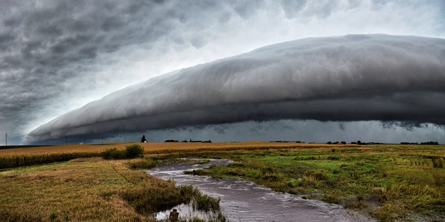
A large shelf cloud slowly approaches over a swollen creek in rural northwest Iowa.
Student Packet: Clouds-Warm Ups, Vocabulary, Information & WorksheetsCLOUDS BOOK PAGES
Clouds, Clouds Everywhere I Look Chant
CLOUDS/FRONTS SIMULATION VIDEO iPAD
Super Awesome Video Link to Understand What Causes Different Types of Clouds to Form! Click button below.CLOUDS BROCHURE
CLOUD FACTSCloud Types Picture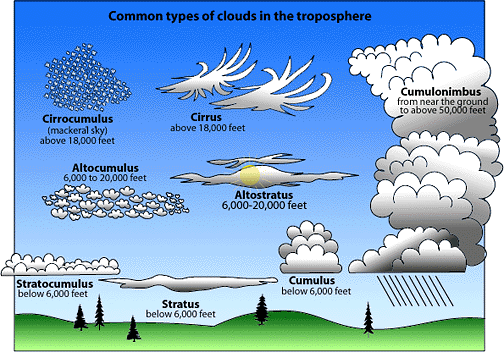
Thank you to F.M.S. student, Cole Smith, for doing the Thinglinks!
Cloud Popplet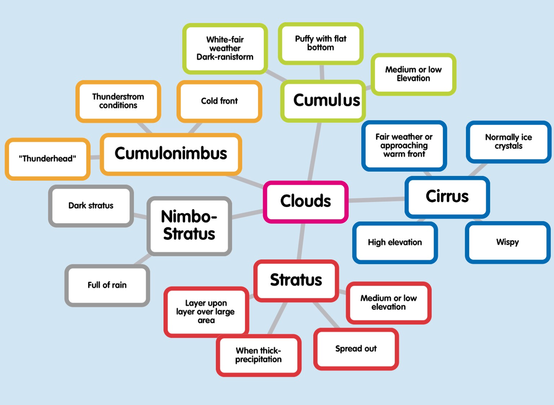
|
Analyzing Weather Map DataLet's Take a Trip-Weather Data Analysis
Student Packet: My Meteorolgist Packet
WEATHER PREDICTIONS FACTSInteresting Storm InformationWeather Station Models & Hurricane Tracking | ||||||||||||||||||||||
